The Permian Basin is a title that is heavy in any boardroom in Houston to Dubai, yet to learn where the real heavy lifting of American energy occurs, you must go West, that is, into the Delaware Basin.
The Delaware Basin functions as a vast, multi-layered subterranean reservoir system, characterized by high-porosity rock units and organic-rich intervals extending several thousand feet in vertical thickness. It is not another oil field, but it is a geological wonder that has transformed sleepy towns of Texas into energy powerhouses around the world.
Understanding the Delaware Basin is no longer optional, whether you are a mineral owner in Reeves County trying to make sense of your royalty paperwork or an investor evaluating long-term development in one of North America’s most productive oil and gas regions.
It is the border between the traditional and state-of-the-art geology and the space-age extraction technology.
What is the Delaware Basin?
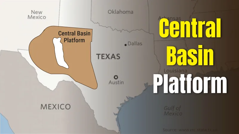
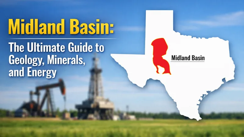
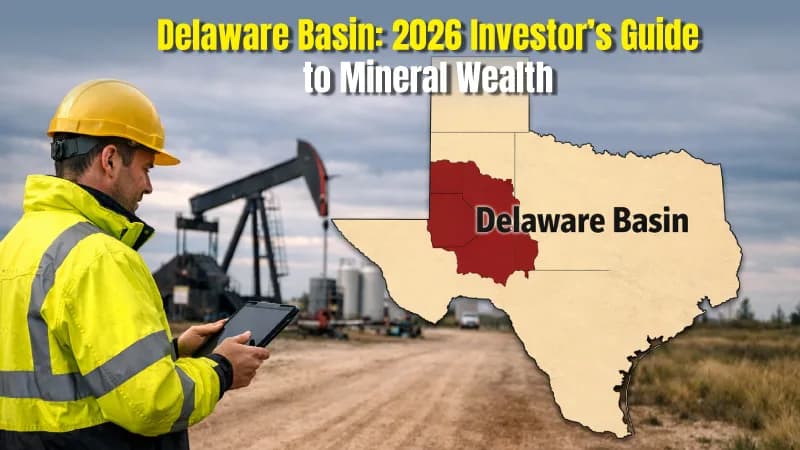
To get our bearings, we have to look at the map of the Permian. The Permian isn't one giant hole in the ground; it's a massive region split into two main "sub-basins" by a high structural ridge called the Central Basin Platform. To the east, you have the Midland Basin. To the west—deeper, hotter, and arguably more complex—lies the Delaware Basin.
The Delaware Basin spans roughly 6.4 million acres across West Texas and southeast New Mexico, including key producing counties such as Reeves, Loving, Ward, Eddy, and Lea. If you were to drive across it, you’d be crossing through:
New Mexico: Primarily Eddy and Lea Counties.
Texas: Loving, Reeves, Ward, Culberson, Winkler, and Pecos Counties.
What sets this area apart from its neighbor to the east is its depth. The sedimentary layers here are much thicker, reaching depths that would swallow the tallest skyscrapers dozens of times over. This depth creates what is known as ‘stacked pay,’ meaning operators can drill multiple horizontal wells at different depths beneath the same surface acreage, extending the productive life of the minerals and increasing long-term royalty potential for owners.
The "Layer Cake" Geology: Why the Delaware is Different
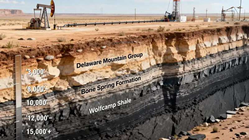
As we analyze the Basin's potential, we must look to its origins in the Permian Period—a restricted marine environment that deposited the high-TOC (Total Organic Carbon) shales we target today. Back then, this area was a restricted marine environment, essentially a giant, salty inland sea.
The "Magic" of the Delaware lies in three specific rock units:
The Wolfcamp Shale:
This is the heavyweight champion of the basin. It is an organic-rich interval that is divided into "benches" (A, B, C, and D). In some parts of Delaware, the Wolfcamp is significantly thicker and more pressured than it is in the Midland Basin, leading to higher initial production (IP) rates.
The Bone Spring Formation:
Lying just above the Wolfcamp, the Bone Spring consists of alternating layers of "tight" carbonates and sands. It’s a complex target, but one that has become a favorite for operators like EOG Resources and Devon Energy because of its high oil-to-gas ratio.
The Avalon Shale:
Often grouped with the Bone Spring, this is a shallower target that provides even more "stacking" potential for mineral rights owners.
| Formation | Depth Range (Approx.) | Characteristics |
| Delaware Mountain Group | '3,000'–8,000' | Shallower sands, historically for vertical wells. |
| Bone Spring | '8,000'–'12,000' | High-quality oil; multi-layered "stacked" potential. |
| Wolfcamp | 10,000'–15,000'+ | High reservoir pressure in the Wolfcamp is a primary driver of strong early production rates and sustained well performance. |
The Fossilized Giant: The Capitan Reef
The Delaware Basin has one of the most impressive appearances; however, it is not subterranean: it is 8,000 feet high. Since the old sea, which had created this basin, started to dry and recede, a great limestone reef developed at the sides. This is the Capitan Reef.
This reef can be traced today in all its glory at Guadalupe Mountains National Park. The famous sheer cliff of El Capitan is literally a fossilized barrier reef that is 260 million years old. For the energy industry, the Capitan Reef marks a geological boundary that helps determine where productive oil-bearing formations are likely to exist, directly influencing leasing activity and drilling decisions.
The Carlsbad Caverns represent an exhumed portion of the Capitan Reef complex, where sulfuric acid, migrating upward from deep-seated hydrocarbon reservoirs, dissolved the limestone to create some of the world's largest subterranean chambers. It is a unique case when the by-products of deep geology formed a layer of wonder on the surface.
Modern Development: The Move to "Cube Development"
If you visited Reeves County in 1990, you would have seen vertical wells pumping slowly. Today, the Delaware Basin looks like a high-tech industrial park. The game changed with the "Shale Revolution," but the Delaware represents the "v3.0" of that movement.
Horizontal Drilling and Lateral Lengths
The 2026 standard has moved beyond the two-mile lateral, leading operators to now routinely execute 15,000 to 18,000-foot 'super-laterals' to maximize reservoir contact from a single vertical wellbore. These "long laterals" (often 10,000 to 15,000 feet) allow a single well to contact a massive amount of reservoir rock.
Stacked Pay and Multi-Well Pads
The modern development approach in the Delaware Basin is known as ‘cube development,’ a method where operators develop multiple wells across several rock layers simultaneously to maximize recovery from a single lease area. Instead of drilling one well and moving on, companies like ConocoPhillips or Chevron will set up a single "pad" and drill 10, 20, or even 30 wells into different layers of the Wolfcamp and Bone Spring simultaneously. This operational efficiency is critical in 2026, as operators optimize for a 'lower-for-longer' price environment with WTI averaging near $51/bbl, ensuring the Delaware remains the most resilient break-even play in the U.S.
Stay ahead of high-impact pad developments near your land with Mineral View’s Lease Activity Tracking, providing you with daily feeds of new permits and completion filings.
The Business of Water: A Billion-Barrel Problem
You can't talk about Delaware without talking about water. For every barrel of oil that comes out of a Delaware well, you might get 3, 5, or even 10 barrels of "produced water." This isn't water you'd want to drink—it's ancient, hypersaline seawater trapped in the rocks.
Managing this produced water has become a massive sub-industry in Texas and New Mexico, directly affecting drilling costs, regulatory approvals, and the pace at which wells can be developed.
Logistics: In the old days, this water was hauled by trucks. Today, the basin is crisscrossed by thousands of miles of "water midstream" pipelines.
Recycling: Operators are increasingly treating and "recycling" this water to use in the next fracking job, which saves money and preserves the local freshwater aquifers.
Disposal: The rest is injected back into deep disposal wells (Saltwater Disposal or SWDs).
The Seismic Reality: Earthquakes in the Basin
This leads to a sensitive yet important issue for any stakeholder of the Delaware Basin: Induced Seismicity.
The past 10 years have recorded a slight increase in the number of quantifiable earthquakes in West Texas. Regulatory data from the Texas Railroad Commission increasingly links this seismicity to deep injection into the Ellenburger formation, leading to aggressive 2026 mandates for shallow-zone disposal or total injection caps in specific clusters. You can add pressure to faults buried deep in the basement and remove millions of barrels of water from deep disposal areas.
This has led to the creation of so-called "Seismic Response Areas" (SRAs). The regulators can now do:
- Restrict the amount of injected water.
- Suspend disposal licenses in hazardous areas.
- Force operators to use less deep zones of disposal.
Today, water management and seismic risk are as critical to project viability as oil prices themselves, influencing where and how operators are allowed to drill. Without a sound strategy on their part in terms of water, the state can even slow down its production.
Don't let regulatory shifts catch you off guard. Set up Notification Agents to receive instant alerts whenever activity or disposal mandates change within your specific Seismic Response Area.
The Economic Landscape: Mineral Rights and Royalties
From a legal and business perspective, the Delaware Basin is a tale of two states.
Texas (The Private Powerhouse):
In Texas counties like Loving and Reeves, most mineral rights are privately owned. This creates a fast-paced leasing environment where mineral owners negotiate directly with oil companies, often under time pressure and with significant long-term financial implications.
Texas maintains a competitive edge through its streamlined Rule 37 and Rule 38 permitting processes, though 2026 has seen increased RRC scrutiny on flaring exceptions and methane emissions monitoring.
Before you sign your next lease, check Mineral Community to monitor local leasing trends and sentiment, ensuring you have the community insights needed to negotiate from a position of strength.
New Mexico (The Federal Frontier):
In Eddy and Lea Counties, a huge portion of the land is owned by the Federal Government (managed by the BLM) or the State. Developing "Fed Land" involves more red tape, longer permitting times, and a higher sensitivity to political shifts in Washington, D.C.
For the local economy, this activity has created a "Permian Premium." Even though the region is sparsely populated, Loving County is famously the least-populated county in the lower 48; the wealth flowing through it is staggering. This has led to "man camps" for workers, a booming trucking industry, and significant tax revenue for local schools.
However, the rapid electrification of the oilfield has put immense pressure on the West Texas power grid. Many operators are now deploying on-site natural gas power generation—utilizing 'captured' flare gas to power electric fracking fleets (e-frac), simultaneously lowering carbon intensity and operational costs.
Investing in Delaware: What to Watch
If you are looking at the Delaware Basin through a financial lens, there are three "Green Flags" to look for:
Inventory Depth:
Does the company have years’ worth of "Tier 1" locations? While isolated exploration success occurs throughout the Permian, the Delaware Basin offers a repeatable, manufacturing-style development program due to its consistent lateral continuity across multiple benches.
Midstream Connectivity:
Oil in the ground is worthless if you can't get it to the Gulf Coast. Companies with their own pipeline capacity or "firm transport" agreements are much safer bets.
M&A Activity:
We are currently in an era of consolidation. Big players are buying up smaller, private-equity-backed firms to "block up" their acreage. This usually leads to more efficient development and better returns for shareholders.
Furthermore, 2026 marks the widespread adoption of AI-driven geosteering. Real-time analysis of 'drilling mechanics' allows bits to stay within the most productive 'sweet spots' of the Wolfcamp benches with sub-meter precision, drastically reducing 'out-of-zone' drilling time.
Future Outlook: What Recent Data Tells Us About the Delaware Basin
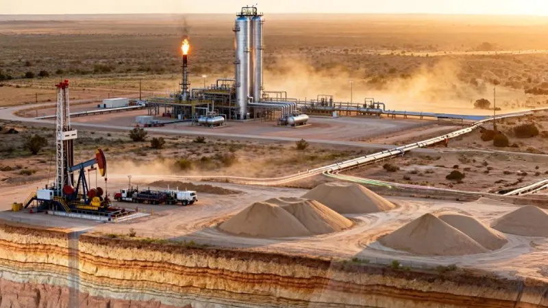
As we look toward the next decade, the Delaware Basin is poised to remain the primary engine of American energy growth. Extensive research and geological data have identified that the basin’s value is far from being fully realized.
While much of the fossilized reef exposed at the surface tells a story of the past, the subsurface assets held by major producers are expected to unlock even greater potential through refined hydraulic fracturing techniques.
To the south, in areas located near the Texas-New Mexico border, recent drilling activity has shown that the stacked pay zones are composed of more than just oil; the source rocks are resulting in massive outputs of natural gas and NGLs, often measured in thousands of boe per day.
Investors should note the rising Gas-to-Oil Ratio (GOR) in older Delaware wells. Managing this increasing gas stream through 2026-commissioned midstream expansions is now the primary bottleneck for maintaining oil production quotas in the southern basin.
For those who want to learn more about the region's longevity, an update on infrastructure is key: new midstream systems have been built to maintain better control over high-pressure yields and water disposal. The Delaware Basin covers a vast territory across West Texas and southeast New Mexico, and current trends suggest that as technology improves, the cost of extraction will continue to drop.
This efficiency ensures that the region remains a top-tier destination for capital, as operators find new ways to maximize every acre of this ancient marine graveyard.
Final Words
The Delaware Basin is no longer an imaginary play; it is the foundation block of the global energy supply chain. It has one of the world's richest geologic depths, high pressure, and a highly developed service business that is making it an attractive site for the most advanced companies in the energy industry.
Though issues such as water management and induced seismicity demand serious engineering and regulatory considerations, the fact that the amounts of hydrocarbons left in both the Wolfcamp and Bone Spring formations are enormous means that this area will not be lost in a few decades.
The Delaware Basin rewards mineral owners and investors who understand how geology, development strategy, and regulation intersect, and it penalizes those who rely on surface-level assumptions. It also compensates individuals who realize that oil and gas no longer revolve around the idea of getting rich; it is the control of huge machinery with high technology thousands of feet beneath the scrubland in West Texas. The Delaware Basin will still remain a point of focus as long as the world requires a well-known energy supply that is both affordable and reliable.